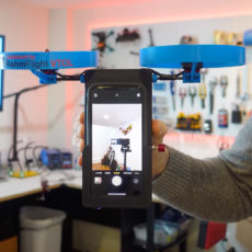
Mini 4 Pro is designed for hobbyists, while the new DJI Zenmuse L2 drone caters to multiple industries for land surveying, forestry, and more. Featuring LiDAR, a self-developed IMU system, a 4/3 CMOS RGB camera, and an integrated three-axis gimbal.
The self-developed IMU (Inertial Measurement Unit) system has been significantly improved and ready to use after powering on the Zenmuse L2. When it is combined with the drone’s RTK positioning system for data fusion during post-processing, the drone provides highly accurate, absolute position, speed, and attitude information. Its 4/3 CMOS sensor sports a mechanical shutter and enlarged pixel size to 3.3 μm, with an effective pixels reach of 20MP. The minimum photo interval has also been reduced to 0.7 seconds, while the mapping camera has a shutter count of up to 200,000 times. Available now directly from DJI, priced from $13,560 USD.

- 𝗟𝗶𝗴𝗵𝘁𝘄𝗲𝗶𝗴𝗵𝘁 𝗮𝗻𝗱 𝗣𝗼𝗿𝘁𝗮𝗯𝗹𝗲 - The drone is lightweight and compact, weighing...
- 𝗡𝗼 𝗥𝗲𝗴𝗶𝘀𝘁𝗿𝗮𝘁𝗶𝗼𝗻 𝗡𝗲𝗲𝗱𝗲𝗱 - Under 249 g, FAA Registration and Remote ID are not required if...
- 𝗘𝘅𝘁𝗲𝗻𝗱𝗲𝗱 𝗙𝗹𝗶𝗴𝗵𝘁 𝗧𝗶𝗺𝗲 - Enjoy longer flights with DJI Mini 2 SE, which offers a 31-min max flight...


The DJI Zenmuse L2 marks a new era of 3D data acquisition. Three years ago DJI was excited to introduce a reliable and cost-effective LiDAR system for aerial platforms used by land surveyors, electricity inspectors, and forestry professionals, to name just a few. This aerial data is paramount in providing real-time 3D data, efficiently capturing the details of complex structures and delivering highly accurate reconstructed models,” said Christina Zhang, Senior Director of Corporate Strategy at DJI.