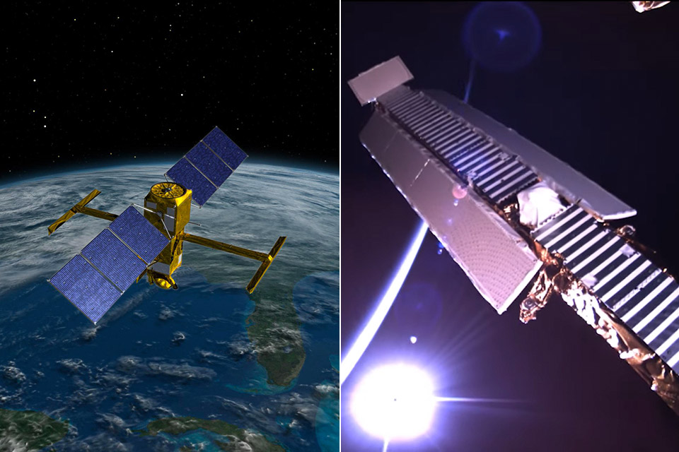
NASA’s Surface Water and Ocean Topography (SWOT) satellite successfully launched into Earth orbit on December 16th, 2022 and captured itself unfolding its large mast as well as antenna panels after deploying the solar panel arrays. Mission control uses telemetry data to monitor and control the satellite, while four commercial cameras record all of the action.
It took the satellite four days to deploy the antennas and two of its cameras focused in on them to capture the mast extending out from the spacecraft before locking into place. These two antennas are a part of the Ka-band Radar Interferometer (KaRIn) instrument that is designed to capture precise measurements of the height of water in Earth’s freshwater bodies and the ocean.

- POWERFUL TELESCOPE FOR ASTRONOMY BEGINNERS: The AstroMaster 130EQ delivers sharp optics, a stable equatorial mount, and smooth manual controls, making...
- HIGH-QUALITY 130MM OPTICS: Enjoy views through the 130mm (5”) Newtonian reflector, which features high-quality aluminum and SiO₂ coatings and...
- SMOOTH, ACCURATE POINTING: Effortlessly aim and center your target using the two slow-motion control knobs for right ascension and declination whether...
The data SWOT provides will help researchers and decision-makers address some of the most pressing climate questions of our time and help communities prepare for a warming world,” said NASA.