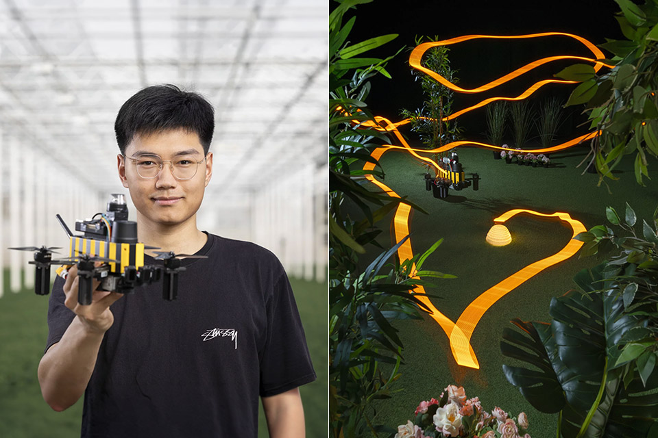
Photo credit: Delft University of Technology | Micro Aerial Vehicles Lab
Researchers at Delft University of Technology have built a navigation method for small drones that copies one of nature’s most efficient routines. Honeybees fly long distances along twisting routes yet still head home with striking accuracy. The new system lets a drone do something similar after just one short practice flight near its base, all while using a learning program small enough to fit in the memory of a basic phone app icon.
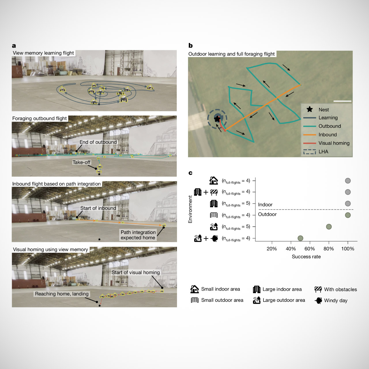
Honeybees keep track of distance and direction by observing how the ground and surroundings move past their eyes. Then, over time, slight inconsistencies begin to appear. To remedy this, bees will frequently undertake a quick small learning flight shortly after starting feeding, looping around the area near the hive and gathering all of their visual memory of what is around them. Later, when they’re far out in the wild, their memories guide them back to the hive, even though they can’t see it.

- Due to platform compatibility issue, the DJI Fly app has been removed from Google Play. DJI Neo must be activated in the DJI Fly App, to ensure a...
- Lightweight and Regulation Friendly - At just 135g, this drone with camera for adults 4K may be even lighter than your phone and does not require FAA...
- Palm Takeoff & Landing, Go Controller-Free [1] - Neo takes off from your hand with just a push of a button. The safe and easy operation of this drone...
A group of Delft researchers wanted to see if a drone might follow a similar path. Rather than develop an incredibly thorough three-dimensional picture of the entire area, as if a robot were trying to recall a complex plan, they just had the thing snap a few short panoramic photos during a quick learning fly around the starting position. They then uploaded the photographs to a small learning system, along with the drone’s initial estimates of how far and in which direction it had traveled. Yes, those calculations become a little jumbled, but the program still manages to extract enough information from the surroundings to determine its home territory and return the drone to that location.
When the drone takes off on a longer flight, it primarily relies on those motion estimates to get there and back, right up until it approaches the place where it learned to fly. The visual portion of the system then takes over and returns the drone to its original location. It also teaches the drone to fly faster when it is still in the wilderness and slow down as it approaches, similar to how bees adjust their own speed near the end of a journey.
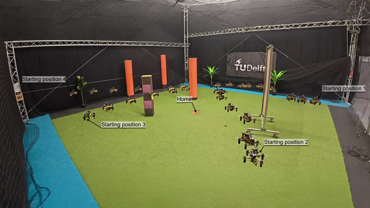
Tests in these huge indoor environments were consistently successful. The drone might take off from a certain position, fly all the way to the other side of this massive hangar or test arena, and then return without ever seeing its home base. Outside, the same method worked fine for a drone that flew more than 600 meters before turning and returning home, and it continued to work well even on calm days, but it began to get a little wonky on windy days, primarily because gusts would blow the drone around and interfere with the camera’s view.
The outdoor version works on a learning system that uses only 42 kilobytes of memory, reducing memory utilization to a minimum. Traditional map-building methods often require substantially more memory and processing capacity, pushing designers to invest more in drones that use more energy and are more expensive to fly. The bee-inspired technique keeps the technology lightweight, allowing small drones to safely fly around people or into places like greenhouses where they don’t want to clash with anything.
Crop monitoring has a clear advantage because a lightweight drone can fly between rows of plants looking for early signs of disease or pests without the bulk or risk associated with larger mapping systems. The same navigation technique makes it perfect for robots moving about warehouses inspecting industrial equipment or functioning in places where satellite signals are distorted due to trees, buildings, or weather.
[Source]