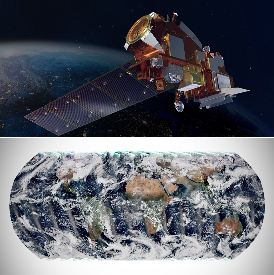
Lincoln Laboratory’s TerraByte Infrared Delivery System will beam data at 100Gbps, while the National Oceanic and Atmospheric Administration’s NOAA-21 satellite uses its Visible Infrared Imaging Radiometer Suite (VIIRS) to capture global visible and infrared observations of land, ocean, as well as atmosphere parameters at high temporal resolution. It began collecting data on December 5th as it passed over the East Coast of the United States and transmitted the first images of Earth.

When NOAA-21 passes over the oceans, its VIIRS instrument measures sea surface temperature, a metric used by researchers for monitoring hurricane formation. It also measures ocean color to give scientists insight on phytoplankton activity, a key indicator of ocean ecology and marine health. When over land, it detects and measures wildfires, droughts as well as floods. This data can then be used to track the thickness and movement of wildfire smoke.

- POWERFUL TELESCOPE FOR ASTRONOMY BEGINNERS: The AstroMaster 130EQ delivers sharp optics, a stable equatorial mount, and smooth manual controls, making...
- HIGH-QUALITY 130MM OPTICS: Enjoy views through the 130mm (5”) Newtonian reflector, which features high-quality aluminum and SiO₂ coatings and...
- SMOOTH, ACCURATE POINTING: Effortlessly aim and center your target using the two slow-motion control knobs for right ascension and declination whether...

One of its most important uses is imagery over Alaska. Up there, the satellites that provide the best imagery are polar-orbiting satellites. This is because these satellites, which orbit the Earth from the North pole to the South pole, fly directly over the Arctic several times a day. One of the unique features of VIIRS is the Day-Night Band that captures images of lights at night, including city lights, lightning, auroras and lights from ships and fires,” said Dr. Satya Kalluri, Joint Polar Satellite System program scientist.