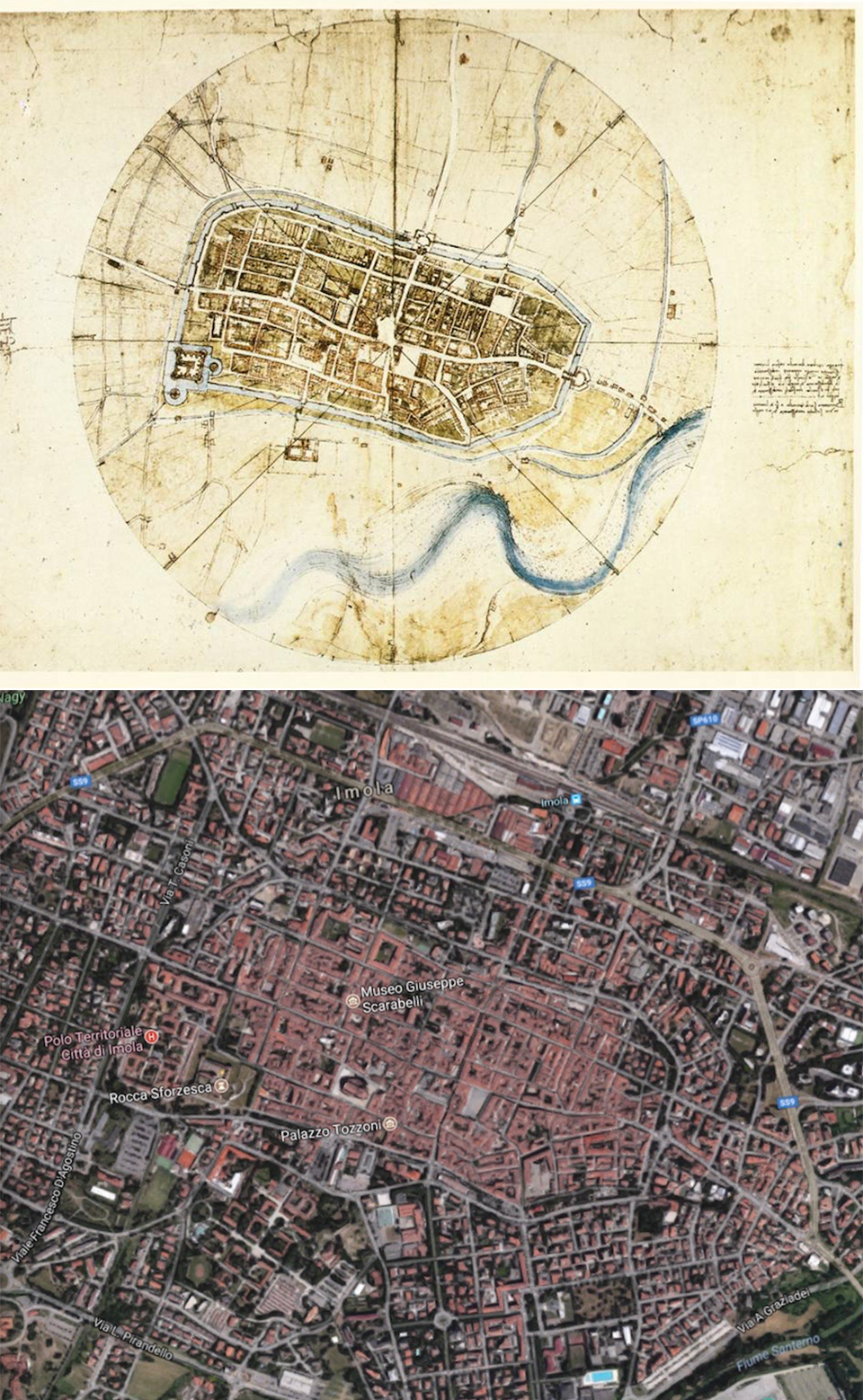
Google Maps is known for its “ichnographic,” or flattened out plan, where all buildings and their features appear perfectly perpendicular to a single, aerial viewpoint, thus enabling users to grasp a city’s entire layout, relative to its environs and the cardinal directions. Today, creating these maps aren’t too difficult, but Leonardo da Vinci managed to make one of Imola, Italy way back in 1502.
Creating this map of Imola may have involved using a special hodometer and magnetic compass that he’d already invented. With careful measurements in hand, he drew every street, plot of land, church, colonnade, gate and square, with everything encompassed by the moat. Da Vinci then centered the plan in a circle with four crossing lines, each representing the points on a compass. And he showed the city ichnographically, as if seen from an infinite number of viewpoints, perhaps inspired by his study of avian flight.

- Assemble your own displayable, 2-seat LEGO Vespa 125 scooter model of an Italian icon with this LEGO building set for adults
- To celebrate Vespa's 75th anniversary, LEGO designers worked with the Piaggio team to create a model to appeal to lovers of Italian culture
- Features a front wheel mounted on one side, a removable engine cover with a brick-built engine beneath, plus working steering